


集信:Old map of Vietnam.jpg

集信㭲 (3.024×2.179點影、戟𡱩集信:1,99 MB、矯MIME:image/jpeg)
Summary
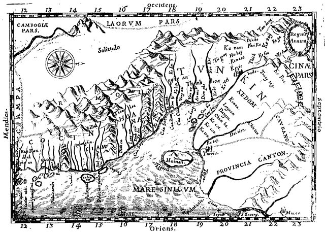
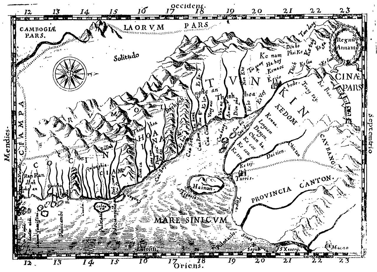
Early Western Map of Tonkin (1651). One of the earliest Western maps showing details of northern and central Vietnam appeared in Father Alexander de Rhodes's Histoire dv royavme de Tvnqvin, published in Rome in 1650. This map is from the French edition, published a year later in Lyon. Oriented with the north to the right, "Regnu Annam" shows the extent of seventeenth-century Vietnam, then divided between two rival dynasties, one in the north and the other in central Vietnam. Remnants of the Cham kingdom, eventually destroyed by the Vietnamese, still exist in the south. To the west, are the highlands occupied by "Rumoi" (upland minority groups, later called "montagnards" by the French). The limited Western knowledge of the interior is illustrated by the large region labeled "Solitudo."
(originally from https://www.loc.gov/rr/asian/guide/guide-southern.html) High-resolution version from The BNF
Licensing
|
This work is in the public domain in its country of origin and other countries and areas where the copyright term is the author's life plus 70 years or fewer. | |
| This file has been identified as being free of known restrictions under copyright law, including all related and neighboring rights. | |
歷史集信
扨𠓨𣈜/𣇞抵䀡內容集信在時點妬。
| 𣈜/𣇞 | 形䀡𠓀 | 戟櫸 | 成員 | 描寫 | |
|---|---|---|---|---|---|
| 現在 | 03:28、𣈜21𣎃4𢆥2011 | | 3.024×2.179 (1,99 MB) | wikimediacommons>Dragfyre | cropped to center the map image |
張使用集信
張𢖖󠄁使用集信尼: